Saint Lucia is located in the Caribbean region at latitude 13.909444 and longitude -60.978893 and is part of the North American continent.
The DMS coordinates for the center of the country are:
- 13° 54' 34.00'' N
- 60° 58' 44.01'' W
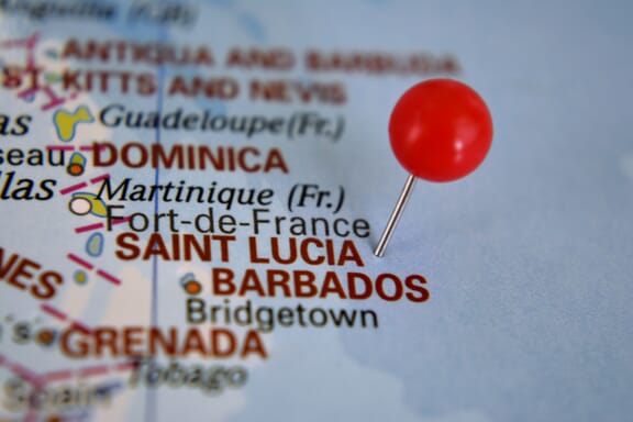
You can see the location of Saint Lucia on the world map below:
The country has no neighboring countries/land borders.
Maritime Borders
Saint Lucia borders with the Caribbean Sea.
Saint Lucia Related Content
Saint Lucia Key Facts
| Country | Saint Lucia |
| Coordinates | Latitude: 13.909444 Longitude: -60.978893 |
| Country Codes | Alpha 2: LC Alpha 3: LCA |
| Country Flag Emoji | 🇱🇨 |
| Int. Phone Prefix | +1-758 |
| Capital city | Castries |
| Continent Subcontinent | North America Caribbean |
| Country Area | 616 sq km |
| Population 2021 | 184,401 World Rank: 177 |
| Median Age | 33.1 |
| Life expectancy | 71.1 |
| Major languages | English |
| UTC/GMT Time | Number of time zones: 1
|
| Internet TLD | .lc |
| Biggest Airport | Hewanorra International Airport (UVF) |
| Average temperature | 25.50 °C 77.90 °F |
| Administrative Divisions | 10 districts |
| Political system | Parliamentary democracy |
Saint Lucia Economy Facts
| World Bank Income Group | Upper middle income |
| World Bank Region | Latin America & Caribbean |
| Currency | Eastern Caribbean Dollar (XCD) |
| GDP in 2020 | $1.6 (billions of USD) World Rank: 173 |
| GDP per capita in 2020 | $8,805 World Rank: 71 |
| Major Industries / Economic Sectors | Tourism, manufacturing, agriculture, energy |
| Top 5 Import Countries | United States, China, Japan, Brazil, South Korea |
| Top 5 Export Countries | United States, China, Japan, Brazil, South Korea |
Biggest Cities in Saint Lucia
Here are the largest cities in Saint Lucia based on 2021 data:
| City | Population |
|---|
| Castries | 70,000 | Gros Islet | 21,660 |