Georgia, situated in the Southeastern United States, boasts a rich tapestry of history, culture, and economic development. Often referred to as the “Peach State,” Georgia is renowned for its agricultural produce as well as industries ranging from media production to automotive manufacturing.
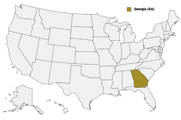
Georgia (GA) on the US Map
The county system in Georgia is central to the governance and administration of the state. Georgia is segmented into 159 counties, each with its own local government and administrative structure.
In this post, we’ll look at a Georgia Counties Map and will dive deeper into the histories, cultures, and unique aspects of some of Georgia’s most interesting counties.
Map of Georgia Counties
Below is a map of the 159 counties of Georgia (you can click on the map to enlarge it and to see the major city in each state).

Click on any of the counties on the map to see its population, economic data, time zone, and zip code (the data will appear below the map). Data is sourced from the US Census 2021.
Interactive Map of Georgia Counties
List of the Counties of Georgia:
| County | Population | Per sq. km | Largest City |
|---|---|---|---|
| Appling County | 18,509 | 14.06 | Baxley |
| Atkinson County | 8,269 | 9.32 | Pearson |
| Bacon County | 11,163 | 15.17 | Alma |
| Baker County | 2,928 | 3.31 | Newton |
| Baldwin County | 43,876 | 65.48 | Milledgeville |
| Banks County | 18,061 | 29.98 | Baldwin |
| Barrow County | 82,138 | 196.93 | Winder |
| Bartow County | 107,868 | 90.75 | Cartersville |
| Ben Hill County | 17,237 | 26.61 | Fitzgerald |
| Berrien County | 18,195 | 15.5 | Nashville |
| Bibb County | 156,711 | 242.62 | Macon |
| Bleckley County | 12,562 | 22.47 | Cochran |
| Brantley County | 18,072 | 15.74 | Nahunta |
| Brooks County | 16,254 | 12.72 | Quitman |
| Bryan County | 43,278 | 38.19 | Richmond Hill |
| Bulloch County | 79,635 | 45.49 | Statesboro |
| Burke County | 24,231 | 11.31 | Waynesboro |
| Butts County | 24,950 | 52.44 | Jackson |
| Calhoun County | 5,668 | 7.81 | Morgan |
| Camden County | 54,256 | 33.23 | Kingsland |
| Candler County | 10,885 | 17.29 | Metter |
| Carroll County | 118,402 | 91.59 | Carrollton |
| Catoosa County | 67,579 | 160.9 | Fort Oglethorpe |
| Charlton County | 12,416 | 6.15 | Folkston |
| Chatham County | 294,815 | 262.81 | Savannah |
| Chattahoochee County | 9,533 | 14.8 | Cusseta |
| Chattooga County | 24,898 | 30.68 | Summerville |
| Cherokee County | 262,155 | 240.38 | Woodstock |
| Clarke County | 128,195 | 415.16 | Athens |
| Clay County | 2,883 | 5.7 | Fort Gaines |
| Clayton County | 294,335 | 802.27 | Forest Park |
| Clinch County | 6,737 | 3.19 | Homerville |
| Cobb County | 762,500 | 866.46 | Marietta |
| Coffee County | 43,048 | 28.06 | Douglas |
| Colquitt County | 45,800 | 32.33 | Moultrie |
| Columbia County | 154,274 | 205.26 | Evans |
| Cook County | 17,188 | 29.05 | Adel |
| Coweta County | 144,928 | 126.87 | Newnan |
| Crawford County | 12,159 | 14.45 | Roberta |
| Crisp County | 20,524 | 29.06 | Cordele |
| Dade County | 16,313 | 36.2 | Trenton |
| Dawson County | 26,202 | 47.99 | Dawsonville |
| Decatur County | 29,020 | 18.76 | Bainbridge |
| DeKalb County | 758,634 | 1094.01 | Atlanta |
| Dodge County | 20,089 | 15.64 | Eastman |
| Dooly County | 11,546 | 11.35 | Vienna |
| Dougherty County | 86,825 | 102.01 | Albany |
| Douglas County | 143,520 | 276.9 | Douglasville |
| Early County | 10,813 | 8.14 | Blakely |
| Echols County | 3,691 | 3.39 | |
| Effingham County | 63,448 | 51.16 | Rincon |
| Elbert County | 19,453 | 21.39 | Elberton |
| Emanuel County | 22,739 | 12.9 | Swainsboro |
| Evans County | 10,761 | 22.72 | Claxton |
| Fannin County | 25,198 | 25.13 | McCaysville |
| Fayette County | 117,828 | 233.83 | Peachtree City |
| Floyd County | 98,210 | 74.38 | Rome |
| Forsyth County | 245,754 | 422.43 | Cumming |
| Franklin County | 23,256 | 34.36 | Lavonia |
| Fulton County | 1,054,286 | 772.78 | Atlanta |
| Gilmer County | 31,047 | 28.13 | Ellijay |
| Glascock County | 2,903 | 7.8 | Gibson |
| Glynn County | 84,373 | 77.63 | St. Simons |
| Gordon County | 57,274 | 62.04 | Calhoun |
| Grady County | 26,076 | 22.15 | Cairo |
| Greene County | 18,461 | 18.39 | Greensboro |
| Gwinnett County | 948,505 | 850.17 | Peachtree Corners |
| Habersham County | 45,767 | 63.82 | Cornelia |
| Hall County | 201,703 | 198.17 | Gainesville |
| Hancock County | 8,652 | 7.09 | Sparta |
| Haralson County | 29,685 | 40.62 | Bremen |
| Harris County | 34,316 | 28.57 | West Point |
| Hart County | 25,808 | 42.87 | Hartwell |
| Heard County | 11,440 | 14.92 | Franklin |
| Henry County | 236,615 | 286.65 | McDonough |
| Houston County | 161,177 | 165.49 | Warner Robins |
| Irwin County | 9,615 | 10.48 | Fitzgerald |
| Jackson County | 73,839 | 83.94 | Braselton |
| Jasper County | 14,478 | 15.17 | Monticello |
| Jeff Davis County | 14,753 | 17.21 | Hazlehurst |
| Jefferson County | 15,708 | 11.52 | Louisville |
| Jenkins County | 8,693 | 9.66 | Millen |
| Johnson County | 9,272 | 11.81 | Wrightsville |
| Jones County | 28,297 | 27.73 | Gray |
| Lamar County | 18,482 | 38.89 | Barnesville |
| Lanier County | 9,874 | 19.4 | Lakeland |
| Laurens County | 49,202 | 23.53 | Dublin |
| Lee County | 32,547 | 35.31 | Leesburg |
| Liberty County | 64,334 | 48.09 | Hinesville |
| Lincoln County | 7,686 | 14.11 | Lincolnton |
| Long County | 16,398 | 15.81 | Ludowici |
| Lowndes County | 117,437 | 91.19 | Valdosta |
| Lumpkin County | 33,188 | 45.29 | Dahlonega |
| Macon County | 12,330 | 11.88 | Montezuma |
| Madison County | 29,906 | 40.9 | Royston |
| Marion County | 7,563 | 7.98 | Buena Vista |
| McDuffie County | 21,727 | 32.59 | Thomson |
| McIntosh County | 11,291 | 10.11 | Darien |
| Meriwether County | 20,659 | 15.92 | Manchester |
| Miller County | 5,984 | 8.18 | Colquitt |
| Mitchell County | 21,940 | 16.54 | Camilla |
| Monroe County | 27,825 | 27.12 | Forsyth |
| Montgomery County | 8,701 | 13.93 | Vidalia |
| Morgan County | 19,694 | 21.89 | Madison |
| Murray County | 39,853 | 44.67 | Chatsworth |
| Muscogee County | 204,366 | 364.46 | Columbus |
| Newton County | 111,262 | 156.9 | Covington |
| Oconee County | 41,006 | 85.89 | Watkinsville |
| Oglethorpe County | 14,779 | 13 | Crawford |
| Paulding County | 165,688 | 204.81 | Dallas |
| Peach County | 27,822 | 71.48 | Warner Robins |
| Pickens County | 32,814 | 54.6 | Jasper |
| Pierce County | 19,644 | 22.28 | Waycross |
| Pike County | 18,754 | 33.51 | Zebulon |
| Polk County | 42,692 | 53.11 | Cedartown |
| Pulaski County | 10,001 | 15.49 | Hawkinsville |
| Putnam County | 21,870 | 24.5 | Eatonton |
| Quitman County | 2,249 | 5.74 | |
| Rabun County | 16,731 | 17.45 | Clayton |
| Randolph County | 6,503 | 5.86 | Cuthbert |
| Richmond County | 205,772 | 244.96 | Augusta |
| Rockdale County | 92,983 | 276.55 | Conyers |
| Schley County | 4,622 | 10.69 | Ellaville |
| Screven County | 14,028 | 8.39 | Sylvania |
| Seminole County | 9,108 | 14.8 | Donalsonville |
| Spalding County | 66,722 | 131.46 | Griffin |
| Stephens County | 26,641 | 57.51 | Toccoa |
| Stewart County | 5,347 | 4.5 | Richland |
| Sumter County | 29,690 | 23.74 | Americus |
| Talbot County | 5,837 | 5.76 | Manchester |
| Taliaferro County | 1,574 | 3.12 | Crawfordville |
| Tattnall County | 23,211 | 18.64 | Glennville |
| Taylor County | 7,857 | 8.05 | Butler |
| Telfair County | 12,860 | 11.35 | McRae-Helena |
| Terrell County | 9,102 | 10.47 | Dawson |
| Thomas County | 45,669 | 32.38 | Thomasville |
| Tift County | 41,148 | 60.9 | Tifton |
| Toombs County | 26,956 | 28.59 | Vidalia |
| Towns County | 12,300 | 28.53 | Young Harris |
| Treutlen County | 6,410 | 12.41 | Soperton |
| Troup County | 69,483 | 64.8 | LaGrange |
| Turner County | 8,856 | 11.98 | Ashburn |
| Twiggs County | 8,034 | 8.63 | Jeffersonville |
| Union County | 24,183 | 28.99 | Blairsville |
| Upson County | 27,424 | 32.73 | Thomaston |
| Walker County | 67,772 | 58.62 | Fort Oglethorpe |
| Walton County | 95,453 | 112.77 | Monroe |
| Ware County | 36,084 | 15.49 | Waycross |
| Warren County | 5,218 | 7.09 | Warrenton |
| Washington County | 20,052 | 11.41 | Sandersville |
| Wayne County | 30,118 | 18.12 | Jesup |
| Webster County | 2,372 | 4.37 | |
| Wheeler County | 7,568 | 9.89 | McRae-Helena |
| White County | 27,886 | 44.72 | Cleveland |
| Whitfield County | 103,076 | 137.02 | Dalton |
| Wilcox County | 8,841 | 9.04 | Abbeville |
| Wilkes County | 9,643 | 7.93 | Washington |
| Wilkinson County | 8,931 | 7.68 | Gordon |
| Worth County | 20,824 | 14.09 | Sylvester |
Biggest Georgia Counties by Population
Fulton County

Fulton County is the most populous county in the state. As of the 2021 US Census, it had a population exceeding one million residents. Located in the north-central part of Georgia, Fulton County is an economic and cultural hub, hosting the state’s capital and largest city, Atlanta.
The numerous Fortune 500 companies in Fulton County and its various media, technology, and healthcare industries make it one of the most economically successful counties in the nation.
In addition to its powerful economy, Fulton County is known for the focus it places on education and healthcare services. It has one of the largest school districts in Georgia, offering a variety of educational opportunities to its residents, and the county’s healthcare infrastructure is expansive.
Another essential feature of Fulton County is its public transportation system. This is facilitated mainly through the Metropolitan Atlanta Rapid Transit Authority (MARTA), which helps connect various parts of the county, including Atlanta, to other areas in the region.
Gwinnett County

Gwinnett County is located northeast of Atlanta and is Georgia’s second most populous county. It’s also one of the state’s fastest-growing counties — once an agricultural community, it has evolved into a diverse suburban hub with sectors ranging from healthcare to technology.
The county is particularly known for its strong educational system. Gwinnett County Public Schools, the largest school district in Georgia, has received numerous accolades for academic excellence.
A Board of Commissioners in the county is responsible for administrative functions and public services, and there is an array of parks and community amenities available to residents. Gwinnett Trails is the county’s system of 145 miles of multi-use paths.
Transportation is facilitated by well-developed road networks and Gwinnett County Transit’s bus services, ensuring effective connectivity within the county and to adjacent areas, including Fulton County and Atlanta.
Cobb County

Situated to the northwest of Atlanta, Cobb County is significant both in terms of population and economic activity. As one of the state’s more developed suburban regions, it provides a balanced mix of residential, commercial, and recreational spaces.
Cobb County’s robust economy is fueled by sectors such as aerospace, technology, and healthcare. Major companies like Lockheed Martin and Home Depot have substantial operations in the area, and this makes it an important employment hub.
Governance in Cobb County is structured around a Board of Commissioners consisting of a chairman and four commissioners, each representing one of the county’s districts. This body oversees various county operations, from public safety to transportation.
The county seat of Cobb County is Marietta, which has an official state history that dates back to 1834. The largest city in the county is Mableton, which was incorporated as a city in 2023 after it was disincorporated in 1916.
DeKalb County

The fourth-most populous county in Georgia is DeKalb County, which is also part of the Atlanta Metropolitan area. It has a diverse population and is made up of a mix of urban and suburban settings, encompassing parts of Atlanta as well as independent cities like Decatur, its county seat.
The county is a significant economic center with a strong focus on sectors like healthcare, education, and retail. Emory University and Georgia State University are both located in DeKalb County and are some of the largest employers in the area.
Public services such as parks, libraries, and a robust public transportation system serviced by MARTA are well-maintained, enhancing the quality of life for residents. There are also a number of attractions for visitors to the region, including the Arabia Mountain National Heritage Area.
Chatham County

Chatham County, located on Georgia’s Atlantic coast, is home to Savannah, the state’s oldest city. Savannah’s well-preserved architecture, cobblestone streets, and iconic public squares make it a popular destination for tourists, enriching the county’s economy significantly.
The economy and culture of Chatham County are influenced by the port of Savannah, one of the largest in the United States, and institutions like Savannah State University and the Savannah College of Art and Design (SCAD). The port enables both domestic and international trade, and the schools attract students from across the country and around the world.
Chatham County’s coastal location adds a unique charm, offering opportunities for water-based recreation and industries. Two protected areas in the county that attract visitors are the Wassaw National Wildlife Refuge and the Fort Pulaski National Monument.
Smallest Georgia Counties by Population
Taliaferro County

With a population of just over 1,500, Taliaferro County is the least populous of all Georgia counties. It is located in the east-central part of the state and was named after Colonel Benjamin Taliaferro, a Revolutionary War hero.
This small, rural county was established in 1825 and consists mostly of farmland, pastures, forests, and streams. Agriculture and small businesses are the main economic activities in Taliaferro County, though it has also served as a filming location for several films.
The county is an important part of the larger picture of Georgia’s communities, but it does experience challenges with limited access to healthcare and education. Some tourists travel to the county to enjoy the pastoral landscapes and to visit the historical landmarks in Crawfordville, the county seat and largest town.
Quitman County

Quitman County, located in the southwestern part of Georgia, has the second smallest population of any Georgia county. Despite its small size, it offers unique features that set it apart from more populous areas.
Primarily rural, the county has a strong agricultural foundation, with farming being a significant contributor to the local economy. Crops such as cotton, corn, and peanuts are commonly grown here, reflecting Georgia’s broader agricultural profile.
Created from parts of Randolph and Stewart counties in 1858, Quitman County was named after John A. Quitman, a leader in the Mexican War and at one time the governor of Mississippi.
One of the key geographic features of Quitman County is its proximity to the Walter F. George Lake, also known as Lake Eufaula. This reservoir offers various recreational activities like fishing, boating, and camping, making it a draw for both residents and tourists looking for outdoor experiences.
Webster County

Webster County is another of Georgia’s less populous counties and is located in the west-central part of the state. It was formed in 1853 from a portion of Georgia’s Stewart County and now covers just over 200 square miles (518 km2).
The county is adjacent to Echeconnee Creek, which not only enriches the local soil but also offers fishing and other recreational activities. It may not be the most famous body of water in Georgia, but this creek plays an integral role in community life and local ecology.
Hunting is a popular pastime in Webster County, and education is consolidated into a single public school that serves all grade levels. The county might not have the urban buzz or extensive infrastructure seen in Georgia’s larger counties, but it boasts a strong sense of community and natural beauty.
Clay County

Located in southwestern Georgia near the border with Alabama, Clay County is a small rural county with an economy that is largely reliant on agriculture. The land was previously inhabited by the Muscogee Creek tribe, who left the area during Indian Removal in the 1830s.
Webster County, like Quitman County, is located in close proximity to Lake Walter F. George, which adds another dimension to the region. In addition to offering recreational activities like fishing and boating to locals and visitors, the lake helps supplement the local economy through tourism and outdoor activities.
The county seat of Webster County is Fort Gaines, a city overlooking the Chattahoochee River. Once called the “Queen City of the Chattahoochee,” the city’s historic district now adds a layer of historical significance to the county.
Notable Counties in Georgia
Clarke County

Clarke County is a consolidated city-county with the city of Athens, located in northeastern Georgia. It’s best known as the home of the University of Georgia in Athens, which was established in 1785 and is one of the oldest public universities in the United States.
The university in Athens serves as a major hub for education and research, but its presence also significantly influences the county’s economy, creating jobs not only in education but also in sectors like real, hospitality, and healthcare to support the student population and faculty.
Geographically, Clarke County is characterized by its rolling hills and rivers, including the North Oconee and Middle Oconee Rivers, which flow through Athens. These natural features facilitate outdoor activities like hiking, fishing, and kayaking, making the area more attractive to locals and visitors alike.
Athens is also known for its music venues, art galleries, and theaters, making it a regional center for the arts. The city has a rich musical history and has been the launching pad for notable bands like R.E.M. and the B-52s.
Richmond County

Richmond County is located in the eastern part of Georgia, bordering South Carolina. It’s most well-known for Augusta, its county seat, largest city, and the second-largest in the state. The county lies along the Savannah River, benefits from a diverse economy, and is historically significant.
In terms of geography, the Savannah River forms the natural boundary between Richmond County and South Carolina. This river has been instrumental in Augusta’s history, initially serving as a trading route during colonial times and now providing recreational opportunities.
Augusta holds international prominence for hosting the annual Masters Golf Tournament at the Augusta National Golf Club. This event draws a global audience and significantly boosts the local economy each spring.
In addition to the golf tournament, the diverse economy in Richmond County includes the healthcare, military, and manufacturing sectors. Fort Gordon, a U.S. Army installation, brings in economic activity and a diverse population. Augusta University, a public research university and medical center, is another significant employer.
Richmond County also has historical significance, with sites like the Augusta Canal and the boyhood home of President Woodrow Wilson.
Bibb County

Bibb County is a consolidated city-county with its county seat, Macon. It’s located in the central part of the state and is known as the “Heart of Georgia.” Macon has a diverse economy and is especially known for its music history and its role as a regional hub for the arts.
The economy of Bibb County is supported by the healthcare, education, and manufacturing industries. Navicent Health, one of the leading healthcare providers in central Georgia, is based in Macon, and the city is also home to Mercer University.
Macon has a rich history of music, particularly in the genres of Southern rock, soul, and R&B. Artists like Little Richard and Otis Redding had roots in Macon, and the city has several music festivals and venues that celebrate this heritage.
Additionally, Macon is considered the “Cherry Blossom Capital of the World” and is home to the Cherry Blossom Festival.
More About Georgia Counties: FAQs
What is the largest county in Georgia by land area?
Ware County is the largest county in Georgia by land area, covering about 908 square miles (2,350 km2).
What is the smallest county in Georgia by land area?
Clarke County is the smallest by land area, covering approximately 121 square miles (310 km2).
Which county is considered the healthiest in Georgia?
Forsyth County has often been rated as one of the healthiest counties in Georgia based on factors like low rates of smoking, access to healthcare, and higher life expectancy.
Which county has the highest elevation in Georgia?
Towns County is home to Brasstown Bald, the highest point in Georgia, with an elevation of 4,784 feet (1,458 meters) above sea level.
What role do counties play in Georgia elections?
Counties in Georgia are responsible for organizing and overseeing local, state, and federal elections. This includes maintaining voter registration databases and conducting vote counts.
Image Sources and Copyright Information
- Downtown Atlanta Skyline at Sunset with Interstate Highway in Foreground: © Kevin Ruck/Shutterstock
- Historic Courthouse Building with Clock Tower in Gwinnett County, Lawrenceville, Georgia, USA: © The Brownfowl collection/Shutterstock
- Bustling County Fair with Food Stands and Ferris Wheel: © William Hunton/Shutterstock
- Facade of the DeKalb County Courthouse at Dusk: © Darryl Brooks/Shutterstock
- Aerial View of Savannah, Georgia’s Downtown Skyline at Dusk: © Kevin Ruck/Shutterstock
- East Facade of the Taliaferro County Courthouse on a Sunny Day: © TampAGS, for AGS Media/Wikimedia Commons | CC BY-SA 3.0 Unported
- Quitman County Courthouse on a Sunny Day in Georgetown, Georgia, USA: © Roberto Galan/Shutterstock
- Webster County Courthouse on a Sunny Day in Preston, Georgia: © Roberto Galan/Shutterstock
- Aerial View of a Small Town with Buildings and Roads Surrounded by Trees: © Felix Mizioznikov/Shutterstock
- Dusk View of the Historic City Hall in Downtown Athens, Georgia: © Sean Pavone/Shutterstock
- Aerial View of Augusta, Georgia Skyline at Dusk: © Kevin Ruck/Shutterstock
- Downtown Cityscape of Macon, Georgia on a Sunny Day: © Sean Pavone/Shutterstock